


Here you have each stage in detail. Remember that if you are doing the self-guided trek, you choose the departure point and the direction of travel. If you are doing the guided trek, the starting point is Gabardito.
There are three variations, these are detailed at the bottom of the page.

Linza – Paso del Caballo – Plana de Diego – Foyas de Gamueta -Paso de Anzotiello -Guarrinza – Selva de Oza.
Time: 6 hours
Distance: 15,3 km
+800m / -1050m
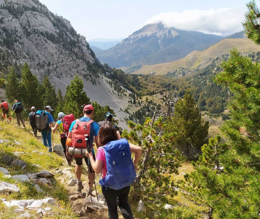
Just in front of the Hostel, take the path to Paso del Caballo and follow towards Anzotiello, Mallo Gorreta, Quimboa and other summits that look like an insurmountable barrier. On the way down to Guarinza we will see various megalithic remains.
Once in Selva de Oza we can enjoy a cold beer under the majestic beech tree of the log cabin.
SELVA DE OZA> < GABARDITO
(BY ACHER)
Selva de Oza – Refugio de Acher – Achar de los Hombres – Foya de Secús -Taxeras – Gabardito.
Time: 7:30 hours
Distance: 15,3 km
+1300m / -1040m
From Oza you skirt the slopes of Castillo de Acher with its incredible limestone cliffs. You will also pass through one of the lesser known but beautiful areas of the Hecho Valley: Secús and Taxeras.


Refugio de Gabardito – Salto la Vieja – Plandániz -Collado de Foratón – (Bisaurín) – Lizara.
Time: 3-4 hours (6 hours with the ascent to Bisaurin).
Distance: 9,6 km
+693m / -536m (plus 700m with the ascent to Bisaurin)
This is the shortest stage if you don’t climb Bisaurin. From Gabardito to Lízara is approximately four hours walk, plus an extra three hours if you make the ascent to Bisaurin. This is a worthwhile climb if you can make it, as it’s the highest summit of the area and has spectacular views.
You can also walk the Sierra de la Cutas, on the right hand side of the Plandaniz col.
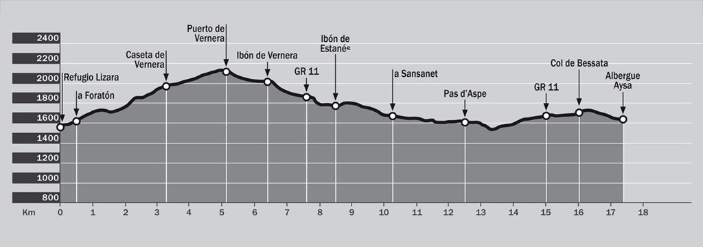
Refugio de Lizara – Paúl de Bernera – Valle de los Sarrios – Ibón d’Estanés – Bosque de las Hayas – Somport.
Time: 6-7 hours
Distance: 17,4 km
+1070m / -980m
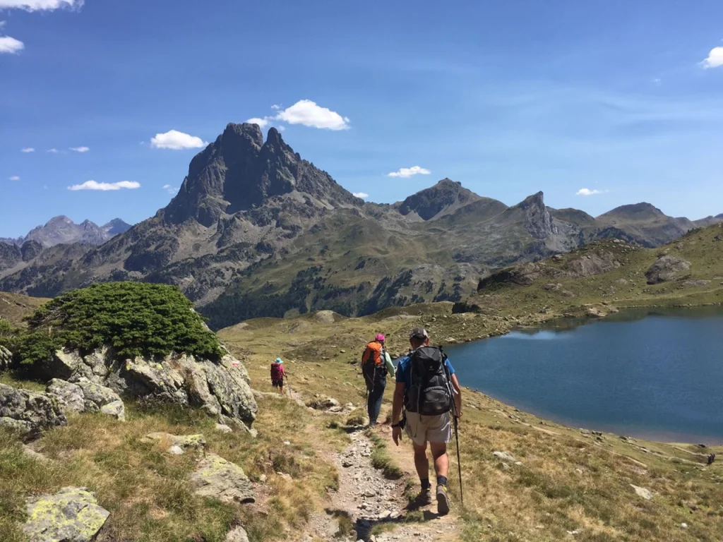
This is one of the nicest stages as both the Valle de los Sarrios (chamoix) and Estanés Lake are astonishing. Although it is a fairly long, it’s not difficult. You begin with a climb or around 2 hours, which then flattens out at Paul de Bernera and the Valle de los Sarrios.
The path then descends to the lake and crosses a beech forest towards Somport. At this ancient frontier you will find the Albergue Aysa.

SOMPORT > < ARLET
Albergue Aysa – Peyrenare – Cabanne de Escuret – Espelunguère – Col de Lapachouaou – Plateau de Banasse – Arlet.
Time: 6-7 hours.
Distance: 18,9 km
+1.148 m / – 781 m.
The forest of Sansanet, the valley of Espelunguère and the hut and lake of Arlet at 2000m are the highlights of this stage. Together with the shepherd’s cabanes and the chance to buy local homemade cheese from them.
ARLET > < LESCUN
Arlet – Col de La Cuarde – Col de Pau – Cabanne de Bonaris – Labrenère – Lescun.
Time: 6 hours.
Distance: 19,5 km
+518 m / – 1.641 m
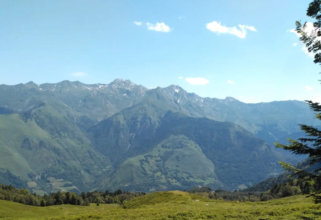
Historic path: Le Chemin de la Liberté, the way to freedom for war persecuted and refugees, also the oldest Camino (St. Jacques) in Aragon. And the prize, the views to the Circle of Lescun on arriving to the valley.

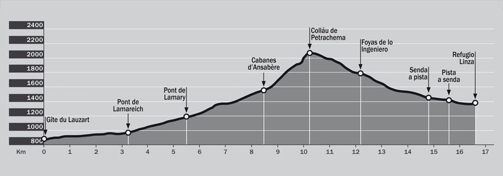
Lescun – Mazouza – Ansabère – Col de Petrechema – Foyas del Ingeniero – Linza.
Time: 7 hours.
Distance: 16,6 km
+1290m / -790m
Here the walk begins on a road, again with impressive views of the Circle of Lescun, formed by the summits of Les Billaires, Mesa de los 3 Reyes (Table of the Three Kings), Petrageme…
At the Ansabere Cabannes there will be a last chance to buy French cheese and from this point, the climbing is harder. Back in Spain, first calcareous zones, later a track through century old beech trees as you descend towards Linza.
Variant
OPTION SELVA DE OZA > < GABARDITO (BY TRAILS)
Oza – Camino Viejo – Lo Jardín – Lo Sacadero – Vía Romana o Senda de los Ganchos – Santana – Gabardito.
Time: 4,30 hours.
Distance: 7km
+400m / -350m
This route is an easier option and also the only option if the visibility is poor up at Castillo de Acher.
Follow the ancient path to Oza, in use since Roman times. Soon a choice of routes will be offered, one on either side of the river, but each with spectacular views of the Hecho Valley.


Variant
OPTION LINZA > < GABARDITO DIRECT
Doing this stage, the path is reduced to 6 days, since the passage through the Selva de Oza is avoided.
Linza – Zuriza – Taxeras – Achar d’Alano – Reclusa – Collado Bajo de Lenito – Santana – Gabardito.
Time: 9 hours.
Distance: 22,5 km
+1640m / -1600m
This is a very long walk so it is advisable to start before 7 am and see the sunrise in Achar de Alano.
Reclusa is a hidden jewel of the Hecho valley, as is the beautiful forest which takes you to the Collado de Lenito Baxo. Descend to Santana (a crossroads between Hecho and Gabardito), saving your energy for the last climb up to the refuge.
Variant
Alternative to walk La Senda en 8 jours.
Somport-Astun-Col de Moines-Refuge d’Ayous-Col d’Ayous-GR10 vers Chemin de la Mâture- Etsaut.
Time: 8,5 hours
Distance: 22,5 km
+ 957m / -2.182 m
From Somport take the road to Astun Ski resort, ascend to Col de Moines and continue to Refuge d’Ayous, by the side of Lac Bersau et the Pic du Midi d’Ossau. Ascend the Ayous col and then start the long descent on the GR10 to Etsaut passing through the spectacular Chemin de la Mâture.
A less demanding route is the Saint Jacques path from Somport to Urdos, and then the Rouglan Col to Etsaut.
Variant
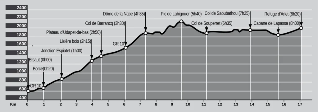
ETSAUT > < ARLET
Alternative to walk La Senda in 8 days.
Etsaut – Borce – Col de Barrancq – Col de Labigouer – Col de Souperret – Col de Saoubathou – Arlet.
Time: 7 hours.
Distance: 17,6 km
+1.500 m / – 300 m
Cross to Borce and follow the GR10 markings until Col de Barrancq. Continue upwars along the ridge towards Saoubathou. The path passes through the cols of Labigouer and Souperret. From the Col de Saoubathou, almost at the Spanish border, take the direction of Arlet.

